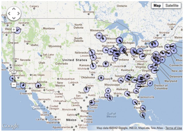
A new mapping
tool released March 5 by the Natural Resources Defense Council (NRDC)
illustrates the potential radiological impacts of a severe accident at
the nation’s nuclear reactors and flags risk factors associated with
each individual U.S. plant. In the year since the disaster, the Nuclear
Regulatory Commission (NRC) has failed to enact a single safety mandate
for U.S. reactors, even though the Nuclear Regulatory Commission advised
a 50-mile evacuation zone for U.S. citizens in Japan—a distance within
which 120 million Americans live from U.S. plants—and there were five
emergency shutdowns at U.S. facilities in 2011, due to earthquake or
extreme weather.
“There are clear lessons learned from the Fukushima disaster, yet our
government allows the risks to remain,” said NRDC Scientist Jordan
Weaver, PhD. “It doesn’t have to take an earthquake and a tsunami to
trigger a severe nuclear meltdown. In addition to human error and
hostile acts, more common occurrences like hurricanes, tornadoes and
flooding—all of which took place around the country last year—could
cause the same type of power failure in U.S. plants.”
The mapping tool uses weather patterns from March 11-12, 2011 to
calculate the radioactive plumes that would have occurred if the
disaster happened at any of the nuclear power plants in the U.S. during
that time.


