According to the Daily Camera, the Boulder City Council last week “voted to move forward with a flood mitigation plan that ignored expert advice, objections from a key project partner, and preferences of the public and a city advisory board.”
Good for the Council.
It dared to think for itself. That’s the good news. The bad news was that the Council was making the best of a bad situation.
The flood mitigation plan the Council adopted was one of the options proposed for CU’s South Boulder Creek property. The plan, affectionately known as “Variant 1,” was selected over the equally evocatively named “Variant 2” plan.
While both plans involve building flood control detention ponds on the property, the Variant 2 calls for 100 acres of ponds while Variant 1 calls for 140 acres. The Variant 1 ponds would hold more water, but not a huge amount more — 1,100 acre-feet compared to 1,000 acre-feet.
(An acre-foot of water is the amount of water that it takes to cover one acre to a depth of a foot — 43,560 cubic feet.)
However, in order to store 1,000 acre-feet of water in the smaller Variant 2 pond, the pond will have to be made deeper, which will require the pond’s spillway under U.S. 36 to be more constricted and more likely to be plugged up with debris in a flood. If that happens, flood water will run over the road and into the residential neighborhoods north of U.S. 36. Variant 1 has a less constricted spillway and is somewhat less likely to plug up, and because the water in the Variant 1 ponds is spread over a wider area it would drain somewhat more slowly.
CU favors Variant 2. It hates Variant 1. That’s because the extra 40 acres of detention ponding will occupy some of the land CU wants to develop.
CU’s development plans for the property, which are somewhat fluid, so to speak, call for building 750 apartments, 375 townhouses — allegedly affordable housing for faculty and staff — and a 1.25-million-square-foot mixed use “academic village” on the western third of the property. Variant 1 looks like it would extend detention ponding into one-quarter to one-third of the land CU wants to develop.
The six Council members who voted for Variant 1 picked the better plan, but the truth is both plans suck.
Both variants have supposedly been designed to cope with a “500-year” flood, a flood that has a two-tenths of a percent chance of occurring in any given year. For South Boulder Creek, a 500-year flood would produce a flow of about 12,000 cubic feet per second (12,000 cfs) at the CU South property.
The trouble is much larger floods have an annoying habit of occurring a lot more frequently along the Front Range than once every 500 years.
For example, on August 1, 1976, a storm dumped 7 inches of rain into the Big Thompson Canyon in an hour, sending a 20-foot wall of water down the canyon that killed 143 people. The Big Thompson River was flowing at 35,000 cfs.
On June 20, 1965, a similar but bigger cloud burst over Plum and Little Turkey Creeks south of Denver causing them to flow at a rate of 100,000 cfs as they emerged from the mountains and ran into the South Platt River. A 6-foot-high wave ran down the river and through Denver. Whole trailer parks that had been built in the flood plain were swept away and jammed into the bridges over the river. The Denver rail yards were devastated. Amazingly only a couple of people were killed, Denver had more than an hour’s warning, but the flood did a billion dollars’ worth of damage. It led to the construction of Chatfield Dam south of Denver.
If the winds had been a little different, either one of these storms could have flooded South Boulder Creek. Or Boulder Creek.
A Big Thompson-size storm on South Boulder Creek would fill the detention ponds in either the Variant 1 or Variant 2 flood control plans in less than half an hour. The flow that caused the Platte River flood would fill them in about 5 minutes.
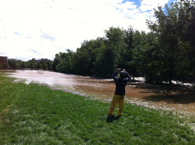
If floods of that magnitude took place on South Boulder Creek — and there is no reason why they couldn’t — the detention ponds would be useless. Even if the spillways didn’t clog up, they couldn’t handle the flow. The water would top U.S. 36 and wreak havoc in the east Boulder neighborhoods north of the highway. It could also back up into CU’s planned housing and academic village.
Here’s an alternative flood plain management plan for South Boulder Creek: Don’t build anything in a freaking flood hazard area like CU South. Sooner or later it is going to get hit by a Big One — and probably a lot sooner than 500 years.
CU should never have bought the South Boulder Creek property in the first place. The most intelligent thing it could do is sell the land to the City of Boulder and Boulder County for open space. It could then take the money and use it to acquire land for housing and an academic village somewhere that isn’t in a flood hazard area.
But there’s no such place in Boulder, you say? You’re probably right. So why not look to, say, Louisville, Superior, Lafayette, Longmont, Broomfield or Westminster? A lot of students are living in those towns already.
CU is already building more and more of its housing and academic buildings away from the central campus — on the east campus and on the east end of Williams Village, for instance. So why not find a site a few miles further out and get a better, safer, cheaper project?
Or just junk the whole CU South idea and use the money for some other purpose — like doing some of the $452 million in deferred maintenance on its existing buildings. Maybe it’s time for CU to quit expanding in Boulder and start taking care of what it has.
This opinion column does not necessarily reflect the views of Boulder Weekly.


