The first time Anna Lee Vargas visited the Sand Dunes, she cried. She was in kindergarten, on an end-of-the-year field trip, and had somehow lost a shoe.
“It was eaten by the creek, and I went back with only one shoe,” she remembers. “It’s out there in the abyss of many other shoes eaten by Medano Creek.”
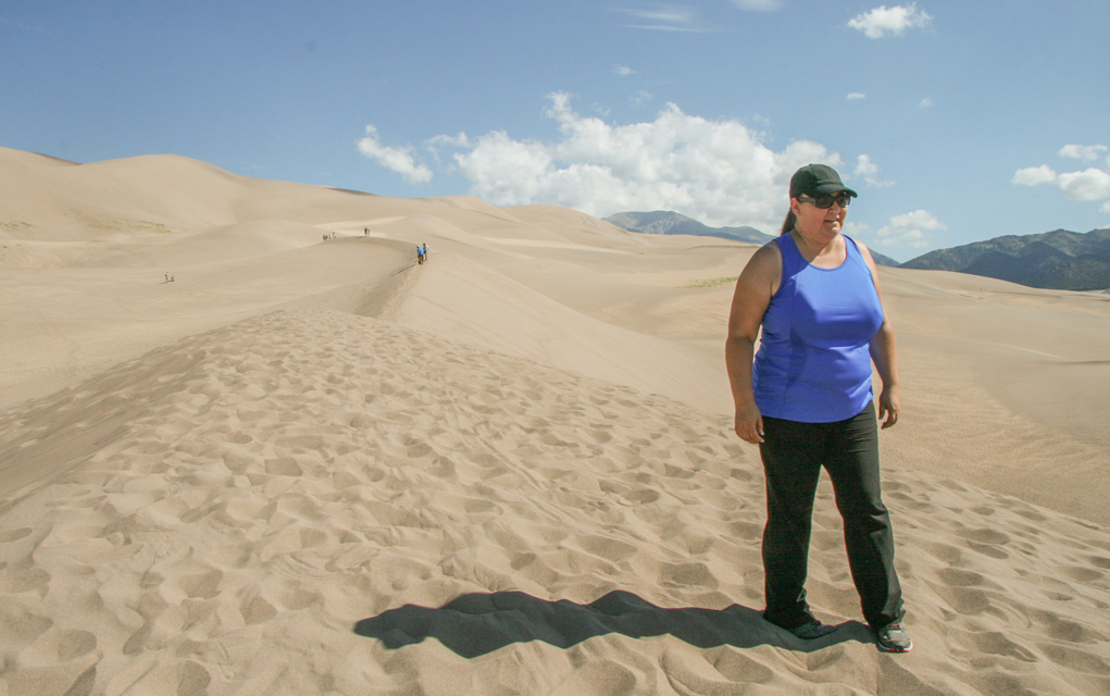
The sixth-generation San Luis Valley native has come back to the national park every summer since, to swim in the creek flowing west out of the Sangre de Cristo mountains and walk the sandy dunes, formed by the mountains that shield the wind and the water that carries the sand back to the valley floor.
She’s continued the tradition with her young daughter — a seventh-generation native — and last year, Vargas says, the creek was so deep they could jump off one of the ledges into its cool waters.
This year, however, Medano Creek didn’t flow to the valley floor. It “trickled down” to the parking area in May, according to the National Park Service (NPS). As of mid-June, “it had retreated back into the mountains” and has been dried up four miles above the dunes since July.
And instead of her annual family trip to the sand dunes, Vargas has been on a mission to prevent oil and gas development on the other side of the mountains near the east entrance of the National Park.
I’m walking with Vargas along a sandy ridge, breathing heavily as our feet move slowly through the deep sand. We’re still relatively low, compared to some of the 750-foot-high dunes — the tallest in North America — that tower in front of us as the dramatic 14,000-foot peaks of the Sangre de Cristo mountains create a dramatic backdrop. It’s mid-July and at 9 a.m. already too hot to walk barefoot in the sand. Still, hundreds of people are hiking around us, setting up sun shades and sledding down the dunes, undeterred by both the heat and lack of water. A mixture of laughter and screams disrupts the otherwise serene landscape.
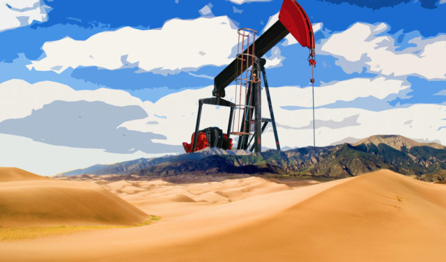
Vargas is the director of project management and community outreach at Conejos Clean Water, a grassroots nonprofit that focuses on environmental, social, economic and food justice issues in the San Luis Valley. The organization is part of a coalition of community and environmental groups working together to prevent the Bureau of Land Management (BLM) from auctioning off 11 parcels, roughly 18,000 acres, for potential oil and gas development in neighboring Huerfano County. Ten of the 11 parcels are within eight miles of the Park’s eastern boundary, Vargas says, one parcel is less than a mile away.
“From our perspective it’s just too close to our dunes, it’s too close to not be concerned,” Vargas says.
On July 10, a few days before my visit, the BLM announced it was deferring these particular lease sales in order to consult with the Navajo Nation, which recently purchased a ranch that encompasses about 70 acres of the potential leases and expressed concerns over their ability to preserve sacredness of their ancestral land. Nearby Blanca Peak (Sisnaajini or the White Shell Mountain) is considered sacred by the tribe.
Vargas seems somewhat relieved by the announcement, but also knows it’s not the end of the threat.
“It’s a small victory; it gives us time to really strategize,” Vargas says. “They could come back and say we talked to the Navajo Nation and we came to a consensus that there really are no concerns and the lease sale is back.”
Great Sand Dunes National Park and Preserve was created in 1999 as an expansion of an already existing national monument formed in 1932. The creation was a bipartisan effort to preserve not only the natural landscape but the deep aquifer underneath the surface. The complex hydrology system comprised of underground water reserves and above-ground wetlands keeps the dunes intact. If, according to NPS, the aquifer gets too low and mountain streams cease to flow, sand recycling would dramatically slow, or even stop altogether.
The park is known as one of the quietest in the country, and its lack of light pollution, plus dry air and high elevation, makes for some of the clearest night skies found anywhere. Bighorn sheep, elk and other wildlife migrate through the surrounding area, on either side of the mountains, both in and outside the park boundaries.
Vargas, and others, worry that energy development, even if it’s on the other side of the mountain peaks, threatens all of this — clear skies, air quality, wildlife migration and water.
“Right now 14 percent of our youth (in the San Luis Valley) have asthma; the rate of asthma in Colorado is 10 percent, so we have a higher rate of childhood asthma as it is. And then we have what is called dark night skies. A lot of people come here for the solace,” she says. “You see this beautiful mountain range? It’s not going to keep out everything.”
But the bottom line?
“Agua es vida,” Vargas says. “We strongly believe that. Water is our most precious resource, and we will defend it. We will fight for clean water.”
The BLM announced the lease sale earlier this spring, when it also released an environmental assessment (EA) that contends there would be no significant environmental impact from opening up the lands to energy development. In March, the agency received more than 4,000 comments during the 15-day window citizens and stakeholders had to submit their concerns or support. This time frame was significantly shorter than those for previous lease sales.
The shortened comment period was implemented by the Trump administration as a national policy in early 2018, part of Department of the Interior Director Ryan Zinke’s leasing reforms. In his Instruction Memorandum, Zinke says the purpose of the policy is “to simplify and streamline the leasing process to alleviate unnecessary impediments and burdens, to expedite the offering of lands for lease, and to ensure quarterly oil and gas lease sales are consistently held.”
In April, Denver-based EPA officials wrote to the BLM, suggesting the lease sale be delayed until a decades-old resource management plan (RMP) could be updated. Since the plan was published in 1995, “the BLM has learned about oil and gas development and about how to protect environmental resources from undue impact,” the letter states. The EPA’s concerns include potential contamination of the Huerfano River downstream of the parcels, the impact of subsurface development on the complex hydrogeology of Huerfano County, and the lack of site-specific air quality analysis over the national park in the EA. The letter also informs the BLM of the Navajo Nation’s recent purchase of Wolf Springs Ranch and advises the agency to consult with the tribe, which, it appears from the EA, hadn’t yet been done.
“This land is sacred, and the Navajo Nation will always protect the beauty and sacredness of the land,” tribal President Russell Begaye told The Denver Post in May. Governor John Hickenlooper, who normally avoids interfering in federal oil and gas lease sales, also asked the BLM to consult with the tribe before proceeding with the sale.
By early July, the BLM announced it was deferring the 11 parcels from the Sept. 6 lease sale in order to formally consult with the tribe.
“We’ll engage in consultation with the Navajo Nation and we’ll determine what, if anything, to do going forward with these parcels. The process has been initiated,” says Steven Hall, BLM Colorado communications director. “It’s a somewhat formal process and we’re probably not going to comment a whole lot about how long that’s going to take or what the nuances are of that process out of respect for the Navajo Nation.”
Still, there’s nothing to say the parcels won’t still be put up for auction at some point. And, according to a lease announcement, “in keeping with the Administration’s goal of strengthening America’s energy independence,” the BLM is still offering up 20 other parcels — totaling 8,160 acres in Kiowa, Lincoln, Washington, Weld, Mesa and Garfield Counties — in its quarterly Sept. 6 oil and gas lease sale. Hall says it’s all part of the agency’s mission as dictated by Congress, and lease sales shouldn’t be a referendum on oil and gas development in general.
“If you’re opposed to oil and gas development there’s probably no way the BLM can do enough to address your concerns,” Hall says, insisting the agency is both transparent and environmentally conscious in its lease sale process. The real question is, “How much of a buffer are you going to have around Great Sand Dunes National Park? Is it going to be one mile, is it going to be 10 miles, is it going to be 50 miles?” he says. “And is that going to apply only to oil and gas? Right now you’re seeing a very spirited debate about that question.”
As we walk back across the dunes and the dry Medano Creek bed to the parking area, Vargas vows to keep fighting oil and gas development in the area, if not for her then for her daughter.
“I have a future generation,” she says. “We’re borrowing [the land] from our children and what are we going to give it back to them with? Are we borrowing this land and giving it back with water we can’t drink? Air we can’t breathe?
“When I’m gone, what’s my daughter going to be left with? What are her children going to be left with? Fracking oil and gas on the other side of the Sangres? And influencing our air quality? I don’t think so.”
As humans, we have to learn how to cohabitate with nature, she implores, and balance our needs with those of the flora and fauna around us. Public health isn’t just about people, she says, it’s about the health of the entire ecosystem.
Driving back to the visitor’s center, she points out the Montville Parking Area on the other side of the road. At the back of the lot is the Mosca Pass Trail — a little over three miles with a 1,500-foot elevation gain and we could be at the east entrance to the National Park and Preserve, less than a mile from one of the potential lease parcels. “You’ll be there tomorrow with Jeff,” Vargas says, referring to Jeff Briggs, the president of Citizens for Huerfano County (CHC), a community group at the forefront of fighting oil and gas development on the east side of the Sangre de Cristo mountains.
“I feel like sometimes the emphasis on protecting the dunes overshadows the beauty of Huerfano County,” she adds.
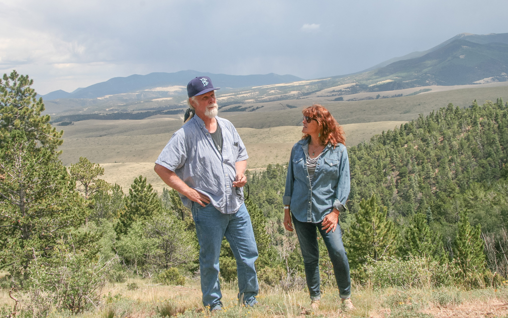
The next morning we meet Briggs and Kim Seng, another CHC member, in the small town of La Veta. As the crow flies, it’s not very far from where we stood with Vargas the day before. In the car, it’s almost two hours away and we still have a few more to go to reach the lease parcels.
As we drive east along Highway 160, we smell the remnants of the recent Springs Fire that ripped through the area. Part of it still burns but the road is open now. It’s rained, so there isn’t smoke in the air. Still, the forest smells damp and smoldering, like the air after putting out a campfire with a bucket of water.
“It’s even more important for us to preserve our Huerfano River headlands, the National Park and Wilderness area. We just lost 110,000 acres,” Briggs says, as we start our drive down dirt roads and around Sheep and Little Sheep mountains to get up to the eastern boundary of the National Park. “So if we have 110,000-acre fire and an 18,000-acre oil and gas lease that becomes active in the most beautiful parts of the rest of the county, it’s a ridiculous waste.”
Briggs has lived in the county since the early 1970s, working in fire mitigation in the southern portion of the state and New Mexico. The pristine landscape and solitude drew him to the area, as it did for Seng, who is a more recent transplant. She came to Huerfano County six or so years ago, in part to escape the fracking fight in the northeastern corner of Ohio and Western Pennsylvania.
Around the turn of this decade, Citizens for Huerfano County formed as a community group dedicated to protecting local public health, safety, environment and wildlife from oil and gas drilling in the face of Shell Oil’s intent to develop the region. The corporation has since left the area, after drilling an exploratory well that proved not to be economical, Briggs says. Still the impact of Shell’s operations are felt, as we drive down a wide, steep, dirt hill carved out by the company to get water trucks and other heavy equipment into the area. The older road can be seen above us out the window, narrow switchbacks cutting across the hillside.
“Huerfano County is famous for not giving up its gold because it just doesn’t have that much gold,” Briggs says. “They tried to uranium mine, that fell apart. Coal was deep-mined, and they got the coal out but now all the coal mines are dead.”
The only truly successful extraction operation in the area, Briggs says, is a carbon dioxide operation run by Occidental, up on the saddle between Sheep and Little Sheep. The gas is pressurized and sent back to the Permian Basin in Texas to reinvigorate old oil wells as a form of secondary recovery. Despite the industry’s promises of economic development that oil and gas drilling brings, Briggs says the costs far outweigh the (rather small) benefits.
“In terms of what it endangers, it’s the last place they should be drilling,” Briggs says. “We’re talking about the entire headwaters for the Huerfano River, the main water source for Huerfano County, being possibly contaminated if there’s any kind of spill whether it’s ground spill or migratory water.”
As we drive north towards Mosca Pass, vertical dykes jut out of the dramatic landscape — rolling hills with a backdrop of the jagged Sangre de Cristo peaks.
“It’s a complex geology,” Briggs says. “Instead of sedimentary horizontal layers of geologic formations, there are vertical ones. So what that does is it fractures all those zones, all those horizontal sedimentary layers, and provides routes for water migration from surface, ground to deep.”
“They are very porous, and they are conduits for fluid,” Seng adds.
Water is a main concern for CHC. In this high drought year, many ranchers don’t have senior-enough water rights to irrigate crops, many people live off of wells on their property, and the Huerfano River is the main water source for the entire county. Not only does the potential for oil and gas development threaten the headwaters of the Huerfano River, you also have to consider one of Huerfano River’s main tributaries, the Cucharas River, which now dries up eight miles uphill from La Veta, Seng says. Both rivers eventually flow into the Arkansas River as well. Any leak or spill from oil and gas development could contaminate it all, Briggs and Seng say.
“I thought for sure this place would be gone,” Briggs says, as we drive along dirt roads recently closed for the fire. Although the rain is a welcome relief, “it’s just a tease,” he says, a small amount of moisture after low snowfall all winter. For the area recovering from massive fire, the moisture is a good sign. But it also brings further destruction as the rain that comes quickly washes away hillsides once protected from sliding by trees and other plants. Soon after we leave, mudslides cover some of the roads.
• • • •
We start making our way up a narrow public road that winds through some of the lease parcels before running through national forest land and up to the National Park boundary.
In the fall of 2017, the Navajo bought the northern portion of the Wolf Springs Ranch, one of the largest in the area, as a way of taking back their ancestral lands. The southern portion was sold around the same time to a man by the name of David Watts, who calls his operation Aught 6. Briggs says Watts portrayed himself to the community as a conservationist, a man interested in building a dude ranch operation and preserving the historic character of the ranch. But soon after he bought the property, Briggs says, he ceded all of the mineral rights to Upland Exploration Inc., an oil and gas company, of which Watts is the president and only employee listed on its website.
“All the mineral rights of the Aught 6 are either owned by the BLM or an active oil and gas exploration company. Not by David Watts the dude rancher, but David Watts the president of Upland,” Briggs says. “He’s wearing two hats: Is one bigger than the other?”
While Watts owns most of the surface land and some mineral rights in the potential leasing area, the rest are “public minerals administered by the BLM,” Hall says.
“These would be oil and gas mineral rights, under private property, which the BLM has no control over. So even if the BLM decides not to offer those leases for sale, there’s nothing that would prevent someone from putting a condominium on it, which I think sometimes gets lost in the discussion,” he continues. “If we just block access to the public’s minerals, we’re going to maintain the area in a pristine state and that’s simply not the case.”
There is no indication at this time that Watts is planing to lease his minerals or otherwise develop his property.
According to Hall, there’s 19 other wells operating in the area as permitted by the resource management plans (RMP) some critics claim are outdated. So in addition to fighting the lease sales, CHC is also petitioning Huerfano County Commissioners to insist on an update to the RMP. Additionally, CHC, Conejos Clean Water and several other environmental public lands conservation groups want further environmental analysis done before the parcels can go up for the lease sale, including a full Environmental Impact Study (EIS) under the National Environmental Policy Act (NEPA). But the BLM’s Hall insists the area’s decades-old resource management plan and the EA are sufficient under the law to offer up the leases.
“They isolate each parcel and start talking about migratory wildlife from just that parcel instead of looking at the entire area,” Briggs says. “So they take it parcel by parcel, isolate them, and say that they find no significant impact for wildlife migration or there won’t be any problem with water. That’s just how they do things.”
Rather, Briggs says, they should be looking at the entire place as an integrated area, ignoring the man-made boundaries that separate national forest, from wilderness area, from national park and preserve. Even the ridgeline on top of the Sangre de Cristo mountains isn’t a sufficient boundary, he says. “[It] doesn’t mean that their hydro-geo systems stop at those boundaries,” he says. “It’s one piece. That’s why they enlarged the monument to become the National Park because they realized there was so much more country that gave creation to the sand dunes and its physical integrity. We’re arguing the big picture too. That’s why we want a hydro-geo study to be done not only on this side where the leases are but extended to the park.”
Looking out across the vast landscape, it’s difficult to imagine drill rigs crossing the rolling hills and gullies, cloud shadows further obscuring the depth of field. It remains unknown where actual oil and gas development, if any, could end up — while the parcels have been mapped out for leasing, there’s still a lot that needs to happen before any wells are drilled in a given area. Exploratory wells and geo-seismic testing are still needed to determine where the hydrocarbons are and in what quantity.
“Folks say, ‘BLM you really ought to say what development will look like before you offer a lease.’ It’s impossible for BLM to predict that,” Hall says. “I think that perspective comes from a place that we really shouldn’t allow energy development on public lands. That’s not the mission that we’ve been given by Congress.”
Briggs decries this public lands philosophy that he says is not new to the Trump administration, but an ongoing tenet of people like the Bundys and the Republican Party. It’s the philosophy, “that public lands should be made available to the people who can exploit them for oil and gas exploration, for mineral exploitation, for ranching. That they shouldn’t be set aside for the public, for us, the common citizen,” he says. “If you have a use which precludes all other uses, that’s what happens with oil and gas, the ‘no trespassing’ signs come up, the trucks, the roads have to be widened for truck traffic, the lights, the pollution, all of it. It precludes people from hiking, using it as a recreational use.”
Hall says there’s very little public surface area land that would be part of the lease sale. He notes that it’s mostly federally owned minerals underneath private land. Still, Briggs, Seng, Vargas and others says it doesn’t matter. If oil and gas development nearby affects other public lands and resources in the area, like the Huerfano River headwaters and the Grand Sand Dunes National Park and Preserve, it’s all the same.
• • • •
It’s raining as we pass the sign marking the boundary of the National Park on top of Mosca Pass. A few hundred yards away I see the covered info board with a trail map detailing the trail down to the sand dunes. Now on national forest land, we drive around the corner to an overlook of the Huerfano Valley, many of the lease parcels in clear view. Briggs points out Blanca Peak, peaking out of the clouds to the south.
“If you read the Navajo and their concerns, it sounds like to me, the Navajo are deciding it’s a bad deal. They can’t guarantee the pristine nature of Blanca and their connection to Blanca via the Wolf Springs Ranch,” Briggs says. “Native Americans are very careful about protecting their turf, they’ve had too much experience getting it ripped out from underneath them. They don’t trust anyone. You’ve got to prove your trust.”
And it’s true. Try as I might, I’m unable to talk to anyone from the Navajo Nation, not even the communications person, before press time. Still, I hesitate to let anyone else speak for them, be it Vargas, Briggs or the BLM.
For now everything hinges on the tribe’s consultation with the BLM. In the meantime, Vargas, Briggs and their respective partner organizations aren’t sitting idle. They still conduct regular conference calls to make sure everyone is up-to-date, enlisting geologists and other experts to talk about the potential impacts oil and gas development could bring to the area. They’re busy educating the community and younger generations about the importance of local empowerment and stewardship of public lands. It’s all in an effort to be ready if, or more likely when, these 18,000 acres are put up for auction.


