The National
Weather Service (NWS) has issued a flash flood warning for the Fourmile Canyon
burn area today until 5 p.m.
At around 1
p.m., the NWS reported “very heavy rain from a thunderstorm near Wallstreet”
moving northeast at 10 mph. Shortly after 2 p.m., the NWS issued a second warning, saying that a thunderstorm was dumping very heavy rain over the Fourmile burn area.
Threatened
locations include Wallstreet, Sunshine, Summerville, Salina, Crisman and Gold
Hill. According to the NWS, a flash flood warning means flooding is “imminent
or occurring.”
“Water will be
flowing down roadways,” the first warning stated. “Rock slides or debris flows can
also be expected.”
The second warning said “two surges of high water and debris flows are expected to move down Gold Run and Fourmile Creek. The second surge is expected to be greater than the first. … This is now a life-threatening situation.”
The warning advises people to avoid driving their vehicles into areas where the water is covering the roadway.
“Turn around … do not drown,” the warning states.
Yesterday, at
around 6:30 p.m., a thunderstorm moved through the Fourmile burn area and
dumped between one-quarter-inch and 1.3 inches of rain in a half hour. At
around 11:15 p.m., a second thunderstorm moved through the same area,
compounding flooding issues. Currently, Boulder County Road Maintenance crews
worked to clear roads and culverts, and all the roads remained open except
Fourmile Canyon from Poorman Road to Gold Run Road and Gold Run Road to Dixon
Road.
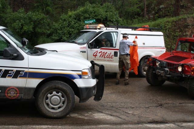
Deputies and
firefighters were in the Fourmile burn area this morning to assist citizens and
assess damages. There were reports of a number of structures and vehicles that
were damaged by the rising water and debris flows.
In addition, in
Boulder yesterday, there were several closures prompted by high water,
including three underpasses along the Boulder Creek and South Boulder Creek
multi-use paths, parts of the South Boulder Creek Trail and a playground on the
banks of Boulder Creek near Broadway.
The Boulder Creek path was closed at the following underpasses:
- 6th Street
- Arapahoe Avenue and 13th Street;
- South of Boulder High School;
- Folsom, near Taft Drive;
-
30th Street, near Scott Carpenter
Park; -
Reynolds Property underpass east of
Foothills; - 55th Street; and
- Valmont Road, east of 55th Street.
The South
Boulder Creek path was closed at the following underpasses:
- Valmont Road;
- Arapahoe Avenue; and
-
Baseline Road (near Bobolink
Trailhead).
Parts of the
South Boulder Creek Trail between South Boulder Road and Baseline Road are also
closed. The paved path between Baseline and the East Boulder Community Center
was open as of yesterday.
Signs and
detours are in place, with cones and signs posted at the sites to direct users
to alternate routes. Bicyclists are advised to be aware of wet conditions
elsewhere on multi-use paths, including the following underpasses:
- Broadway;
- 17th Street;
- 28th Street; and
- Foothills.
Cyclists and
other users are advised to use caution while in these areas.
The playground
located south of Boulder Creek immediately west of the Broadway Bridge is also
closed until further notice due to high water in the area.
The Boulder
County Sheriff’s Office has a tubing ban in effect for Boulder Creek due to the
high creek volume.
The city
anticipates water levels in Boulder Creek to remain high for the next several
weeks.
For more
information, visit www.boulderconezones.net.


